
In my current job role, I sometimes need to use Point to Point (PtP) Wireless links to reach some other areas that were previously unreachable. The links are mostly basic and I haven’t yet done anything too crazy relating to this subject such as detachable antennas, really long distances, or licensed frequencies, but maybe one day I will get these experiences. This is not usually my first choice but this is what I turn to when I need a reasonably inexpensive solution for connectivity. From a different conversation, Keith Parsons shared with us a great piece of information relating to the different mediums, so I decided to reuse it, Thanks Keith. “Just remember, fiber trumps copper, copper trumps PtP wireless, PtP Wireless trumps Wi-Fi, Wi-Fi trumps Mesh. Not to mention… 5GHz trumps 2.4GHz so don’t put anything ‘important’ on 2.4GHz.”
With that being said here are a few helpful tools that I found aid in this process.
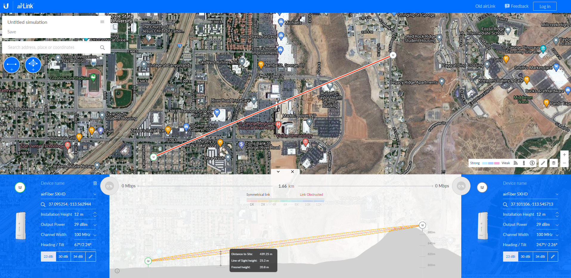
Ubiquiti airLink – Web
This is usually my go-to for figuring out locations of where I’m roughly looking to get connectivity to. Depending on how updated your area is this can be a great starting point or give you a false sense of hope. Some things that I really like about this, if I am able to get my rough placement correct, this will show me if I am able to achieve line-of-sight based on a topographical view, what the path will be, and if there is any potential blockage to the fresnel zone. (pending I am using a standard frequency and one of their antennas) From here I will use this to help identify items that can be used as reference points along the path. This is helpful by making sure I am looking at the correct area when I arrive on site. Also taking a screenshot of the path and some of the reference points helps me remember where I should be looking.

Binoculars
A good pair of Binoculars (or some other devices that you can use to you see further) helps greatly when going onsite and trying to figure out if you truly do have line-of-sight to your target locations. For shorter distances, this is not a big deal, but it does help when trying to identify if you are looking at the right destination, I have found that when looking at rooftops a lot of them look very similar and it’s hard to properly distinguish them.
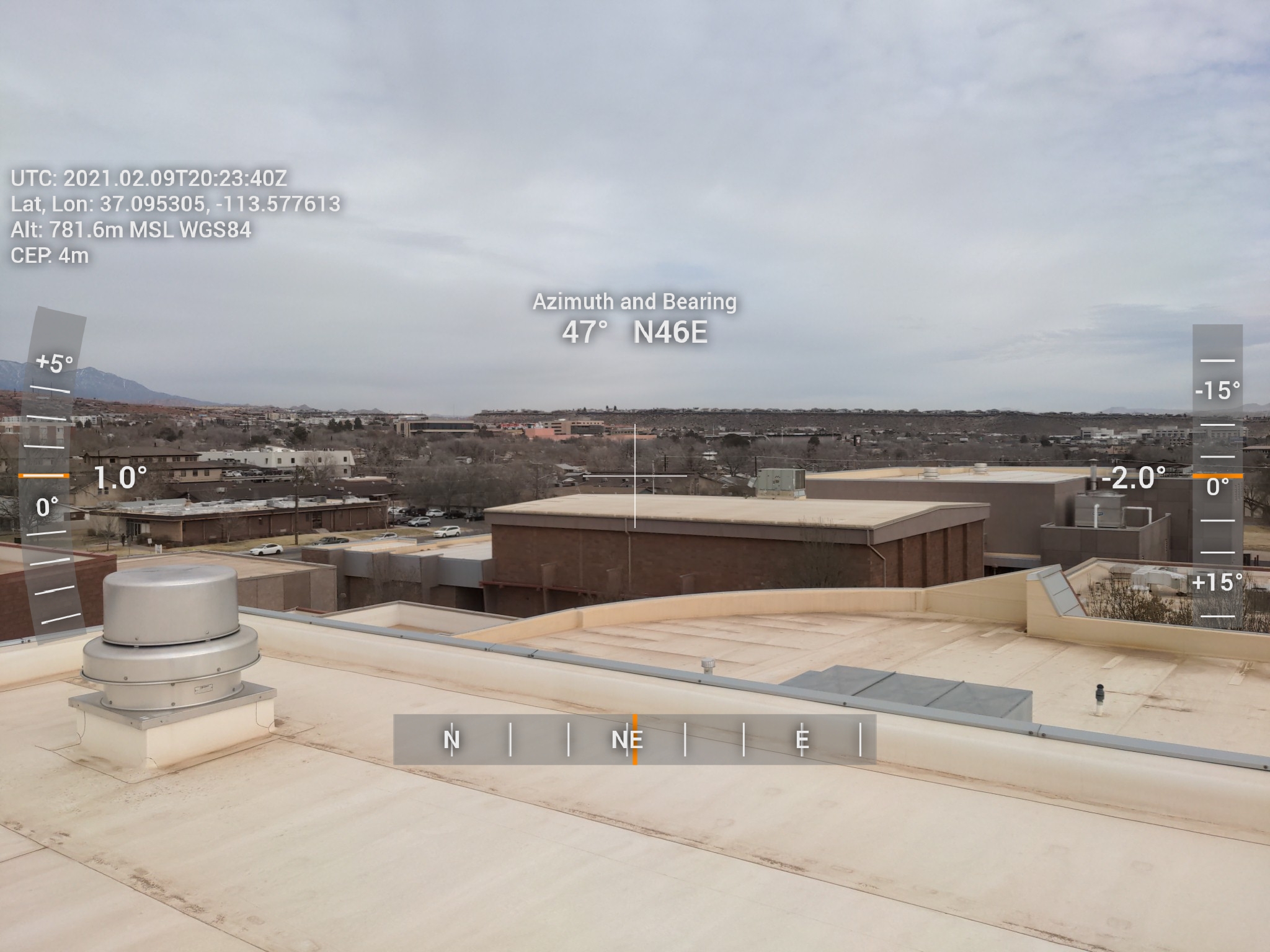
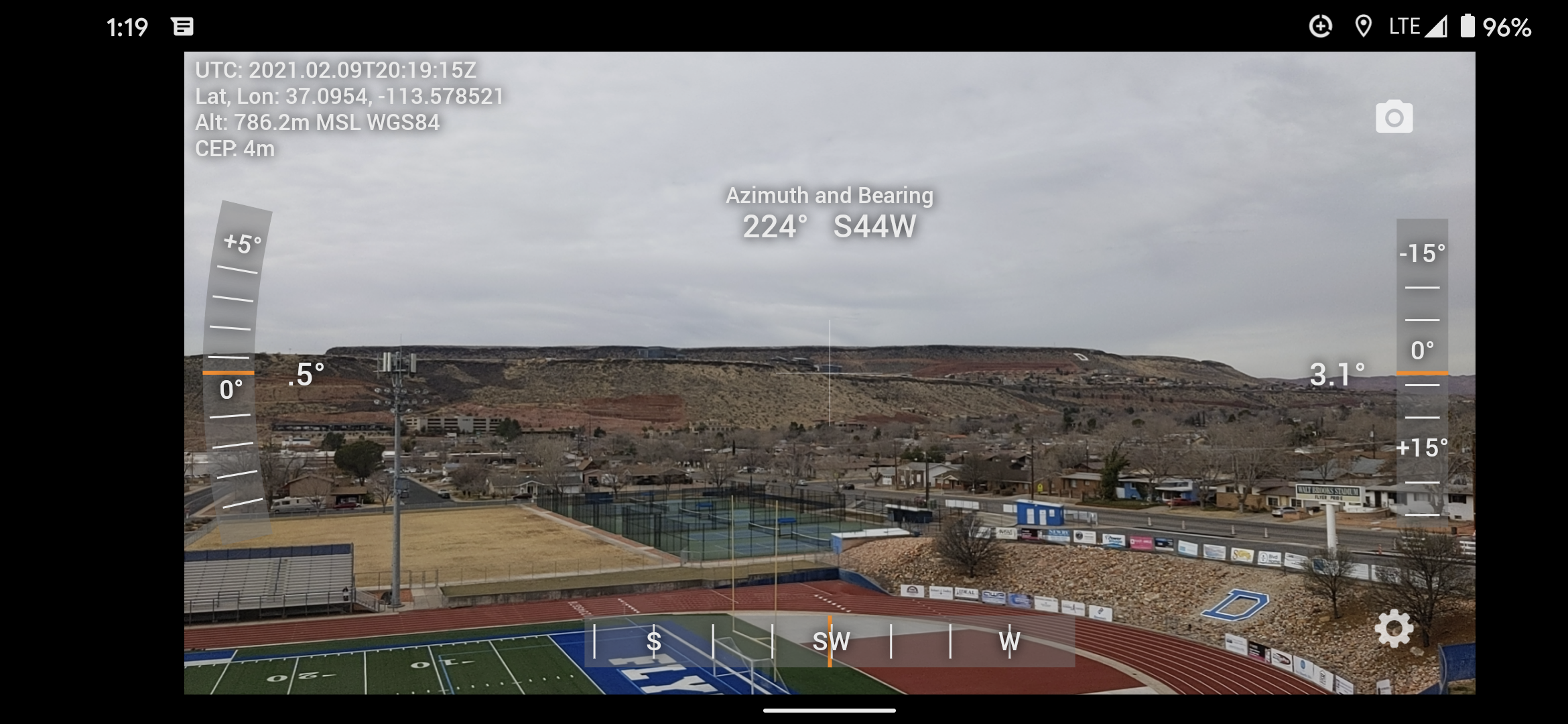
Dioptra™ Lite – Android or Theodolite – iOS
To build on the last sentence, I have found these tools to be a great help for properly identifying which rooftop I am looking at. This allows me to make sure I have the proper line of sight before starting any kind of installation. In addition, I can use the heading (and sometimes the tilt) from the Ubiquiti airLink site to verify that I am looking at the right location, since my memory is not the best at times, I have found that taking a screenshot of what I am looking for provides me the documentation I will need for a project and also helps me remember what I was looking at and what obstacles I may face.
Conclusion
These are some of the things that have helped me in planning out a location to use for PtP wireless links, if you have any other tips or tricks you have found helpful, please let me know and I will add them to this post or make a follow-up to it. Thank you for taking the time to read this.